
Around the world in three numbers
A guide for remembering distances across lands and oceans around the world.

If you find this newsletter informative, please share it with other people you know!
Over the coming weeks and months, I’ll be sharing tips and tricks to better understand geography. For the first one, I’d like to share a heuristic (mental shortcut) for remembering distances across land masses and oceans.
The good news is you only need to remember three numbers:
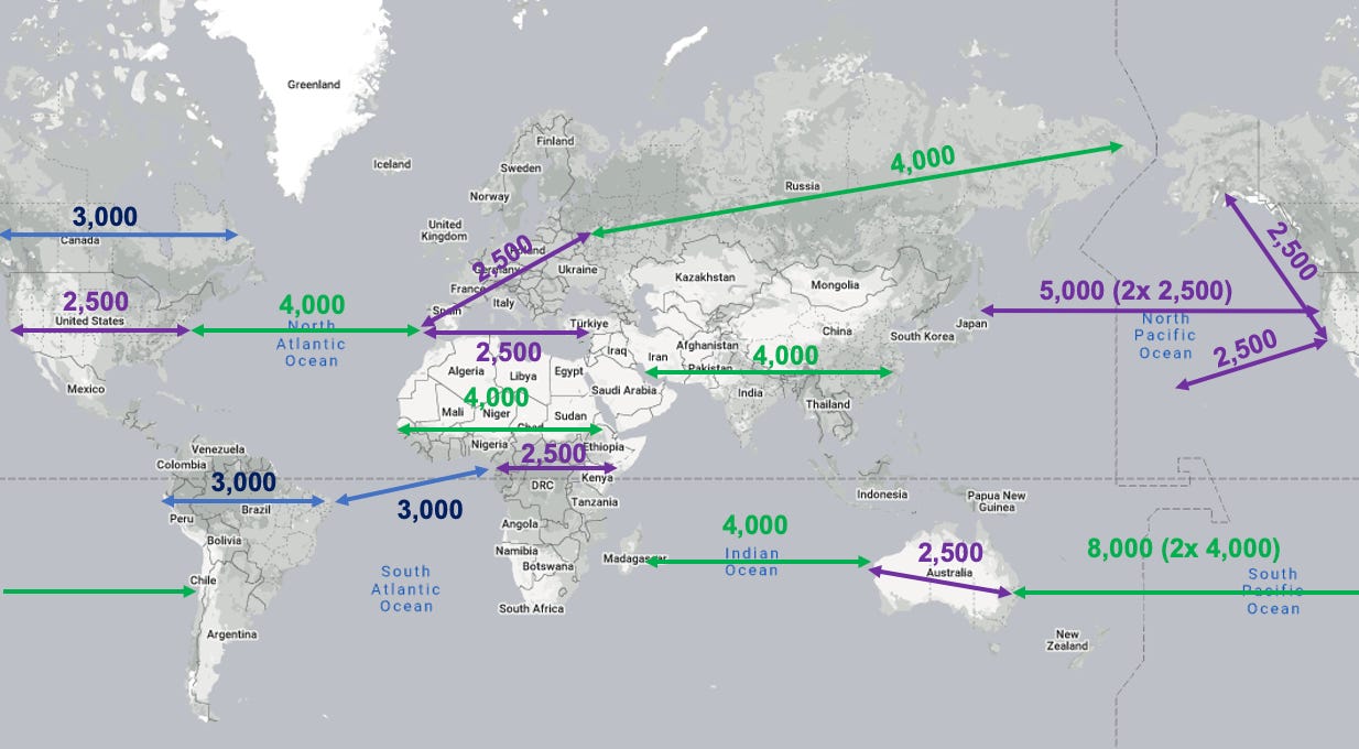
2,500, 3,000, and 4,000
Yep, that’s it. Here’s how they look on a map:
Before we jump into specifics of each measurement, I want to provide some disclaimers:
1. All the distances I’m providing are in miles…sorry if you use the metric system.
2. The distances I’m providing are not exact. Some distances may be off by 100 miles, or a little more. Remember, this is meant to be a guide. Still, it should get you in the ball park if you’re competing during trivia night at your favorite bar.
3. (This is where it gets a bit complicated) Because the earth is a sphere, the shortest distance between two points is not necessarily a straight line, but instead an arc called “a great circle.” You can read more here and here.
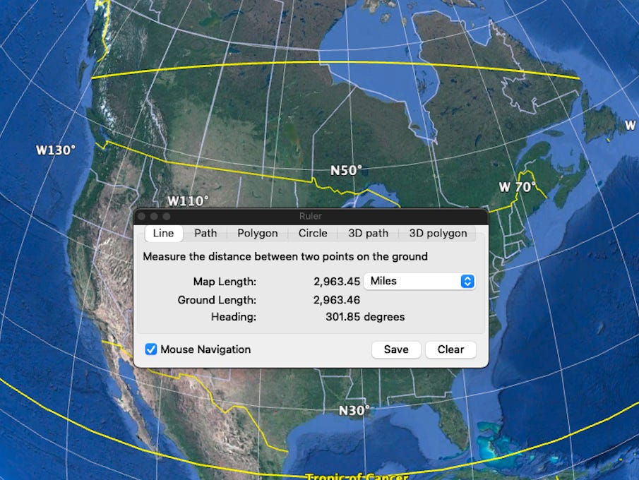
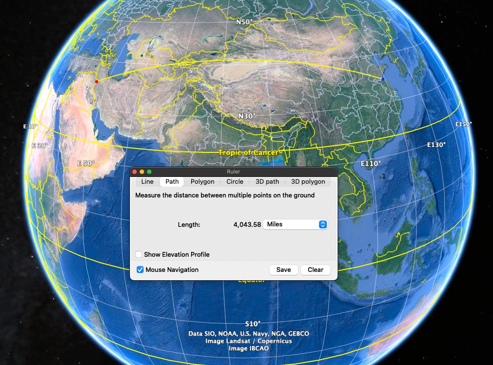
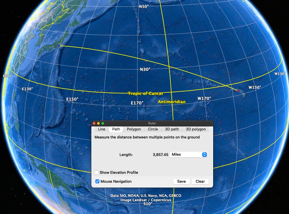
To understand what I mean, take a look at the picture below.
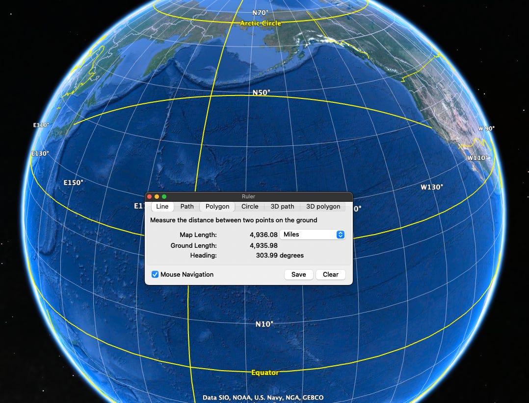
The yellow path that arches across the top is the shortest distance from the U.S. mainland to the Japan mainland; you’ll notice that it is not parallel to the latitudinal lines (the white lines that go left and right). If you were to measure the distance of a path that stays at the same latitude, then it would be longer. In the image above, the distance along the latitude would be about 300 miles longer—and this is why ships and planes use great circle routes instead. If you’re interested in learning how to calculate the distance of two points that sit at the same a latitude, you read about it here.
The farther away from the equator, and the longer the distance you’re traveling, the greater the differences will be between great circle length and the length along a latitude.
For this guide, I’ll be using great circle distances.
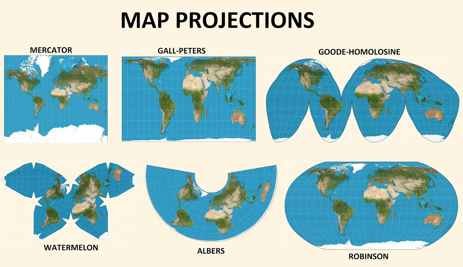
4. Also, because the Earth is a sphere, land masses appear different sizes depending on the type of map you are using; below is an image that shows a few map projections. The important thing to take away from this is that you can’t judge the true size of a land mass based on a Mercator map (which we typically use). This is why I’ll be using The True Size Of website to show comparative sizes and distances.
Okay, with all of that out of the way, let’s jump in!
North America
Canada is roughly 3,000 miles wide.
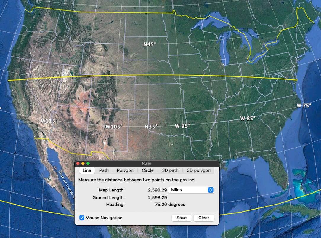
The United States mainland is roughly 2,500 miles wide at the center. This may surprise you, but if I measure from Washington State to Maine, it’s only about 100 miles longer.
Interestingly enough, the distance from Los Angeles to Hawaii, and Los Angeles to Anchorage, is also roughly about 2,500 miles:
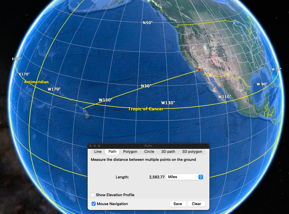
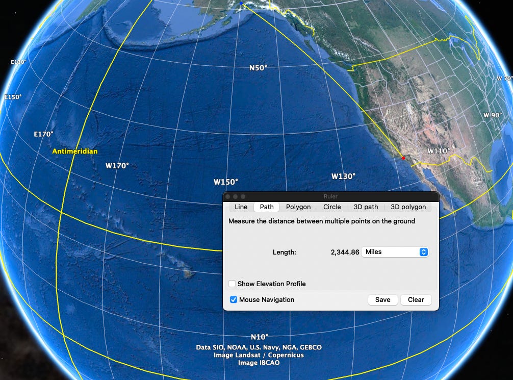
Yes, I know it’s not quite 2,500, but close enough.
South America
South America is roughly 3,000 miles wide.
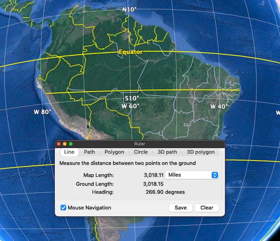
The distance from South America to Africa is around 1,800 miles at its shortest, and about 3,000 miles where they fit together like puzzle pieces.
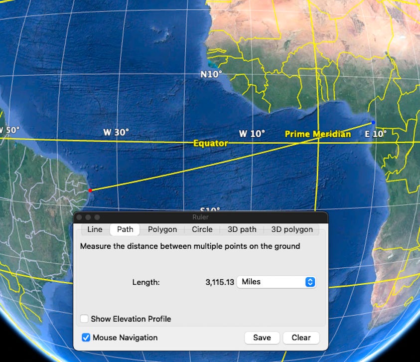
Again, not exactly 3,000, but close enough.
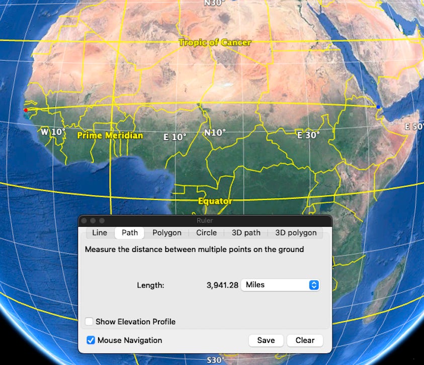
Africa
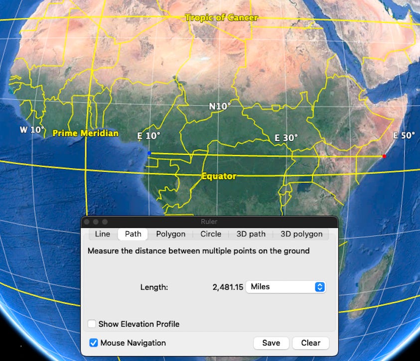
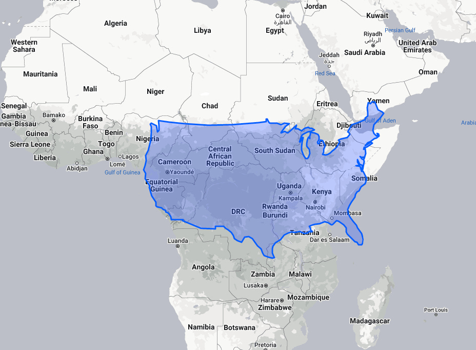
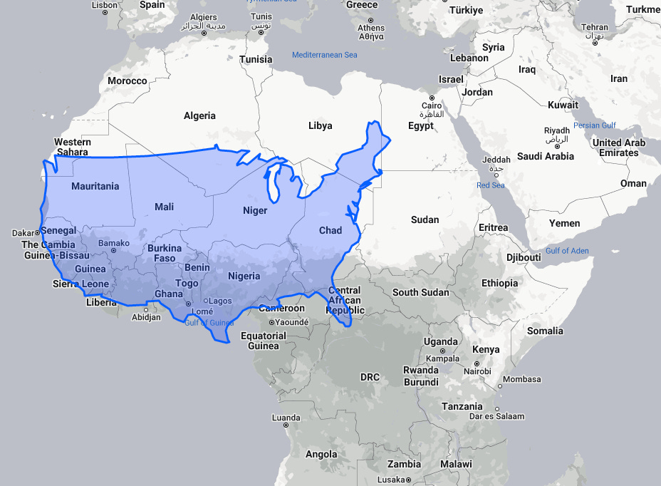
Below you’ll see that Africa is roughly 2,500 miles wide near the equator (it’s actually 2,300 miles wide exactly at the equator).
Seriously, the skinnier part of Africa is the size of the US? Yep:
And, it’s roughly 4,000 miles wide at the base of the Sahara desert.
Compared to the US, for reference:
Europe
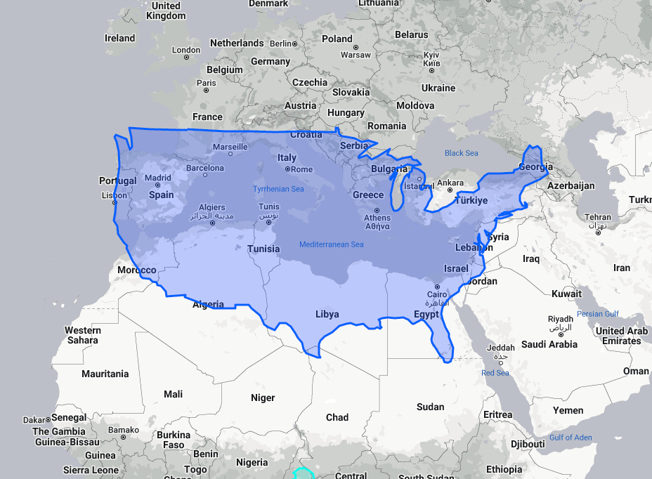
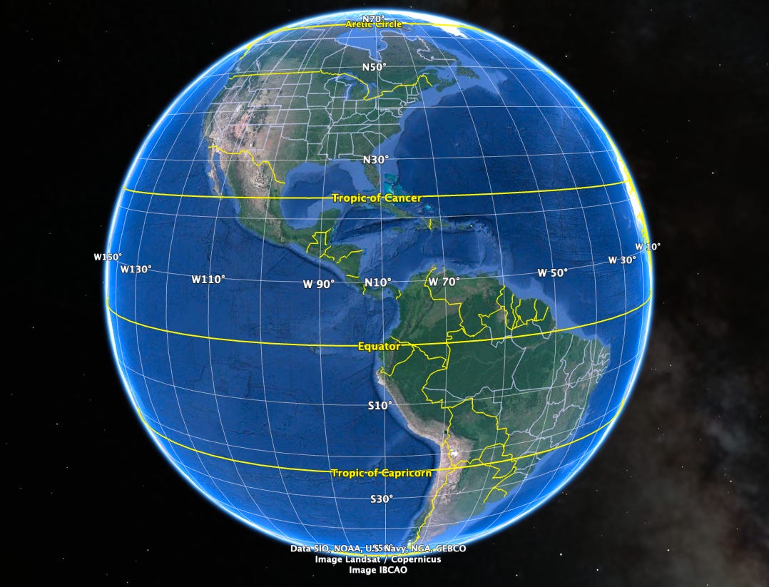
It’s roughly 4,000 miles from the U.S. to the Mediterranean.
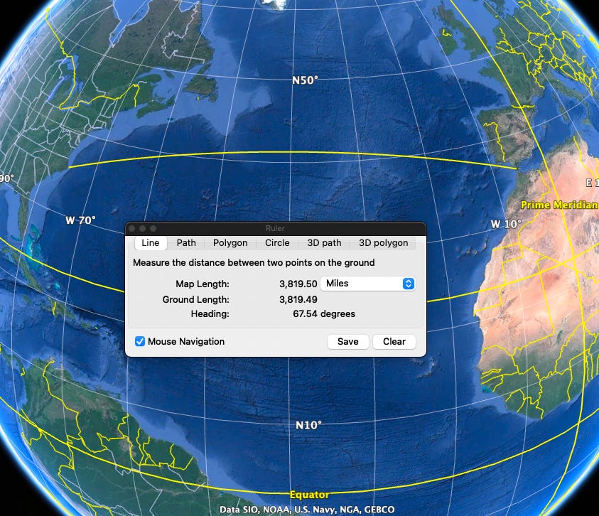
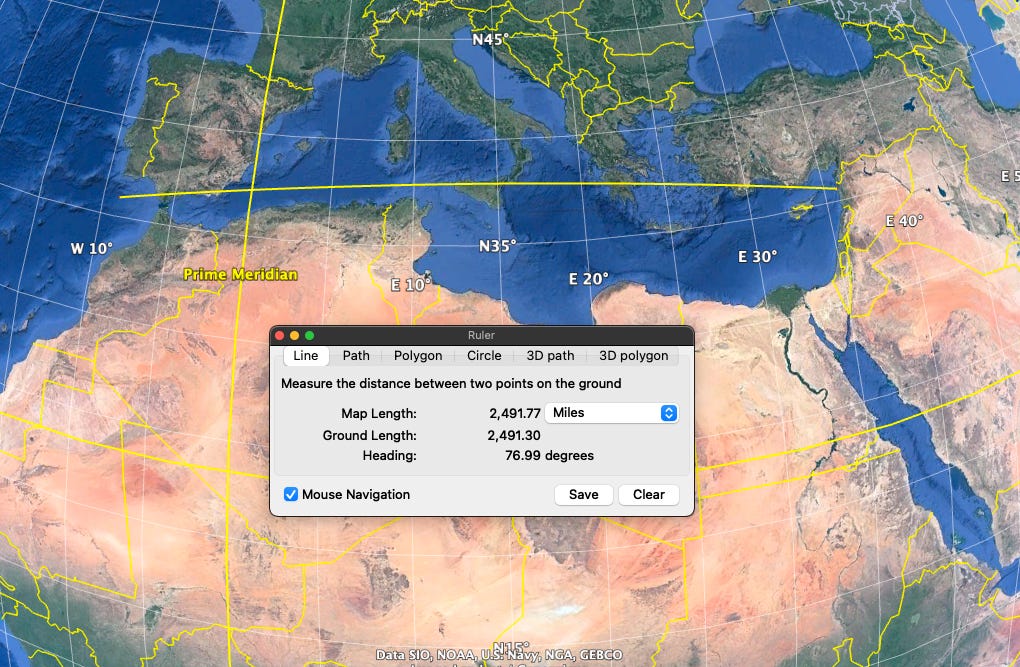
And roughly 2,500 miles across the Mediterranean (measured to the outer part of Portugal).
Here’s a comparison of the Mediterranean and the US:
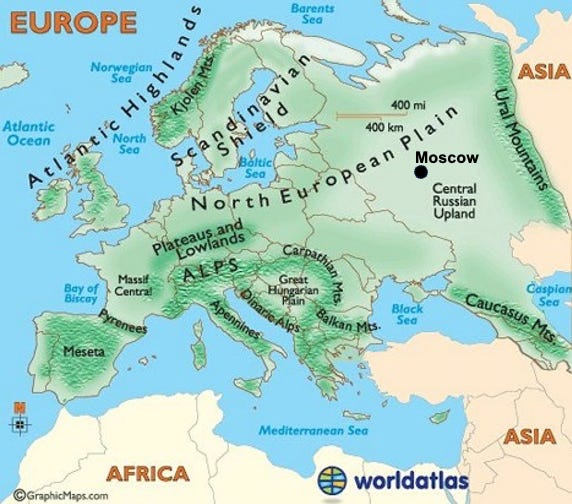
The continent of Europe, and the countries of Europe, are really two different things. The continent of Europe stretches into Russia to the Ural Mountains. See image below.
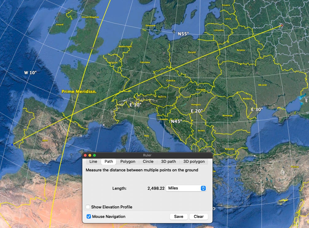
However, instead of measuring to the Ural Mountains, or to the eastern edge of Belarus or Ukraine, let’s just measure Europe from the west coast of Portugal to Moscow…which conveniently works out to about 2,500 miles (😊). For reference, Moscow is about 300 miles from the border of Belarus and Ukraine and about 800 miles from the Ural Mountains.
Here’s a comparison of the US and Europe:
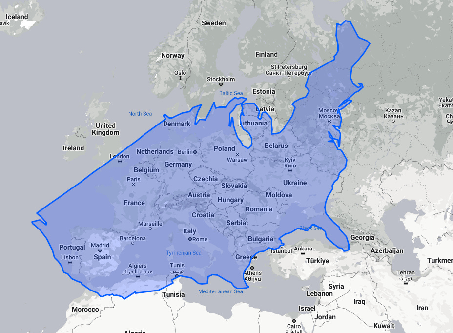
As an aside, when you see it in this perspective, you can better understand why both Napoleon in WWI, and Hitler in WWII, overextended their logistics lines when trying to capture Moscow. This error, especially by Hitler who should’ve learned from Napoleon’s example, meant their respective forces were ill prepared for the winter weather, and unable to conquer and hold the territory. As an aside to this aside, the novel War and Peace by Leo Tolstoy focuses on Napoleon’s invasion of Russia.
Asia
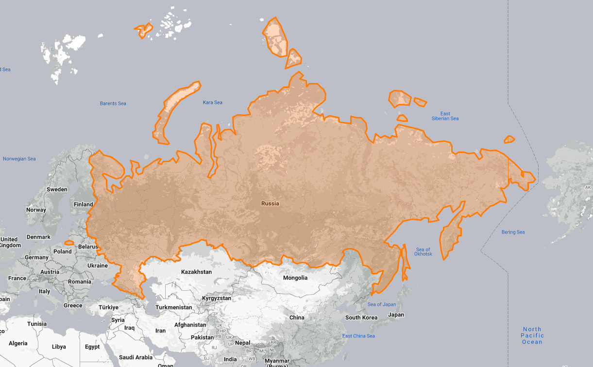
Here’s where things get a little wonky due to how far away we’re getting from the equator and how oddly shaped Russia appears. On a Mercator (flattened) map, this is what Russia looks like:
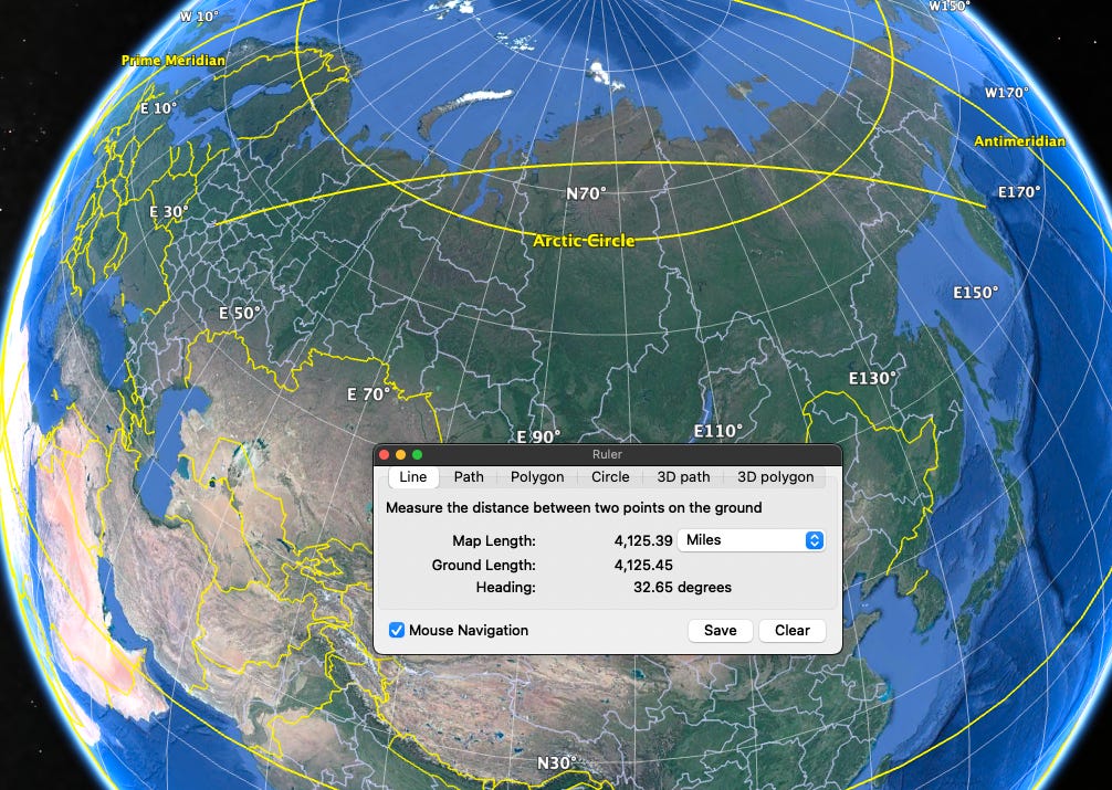
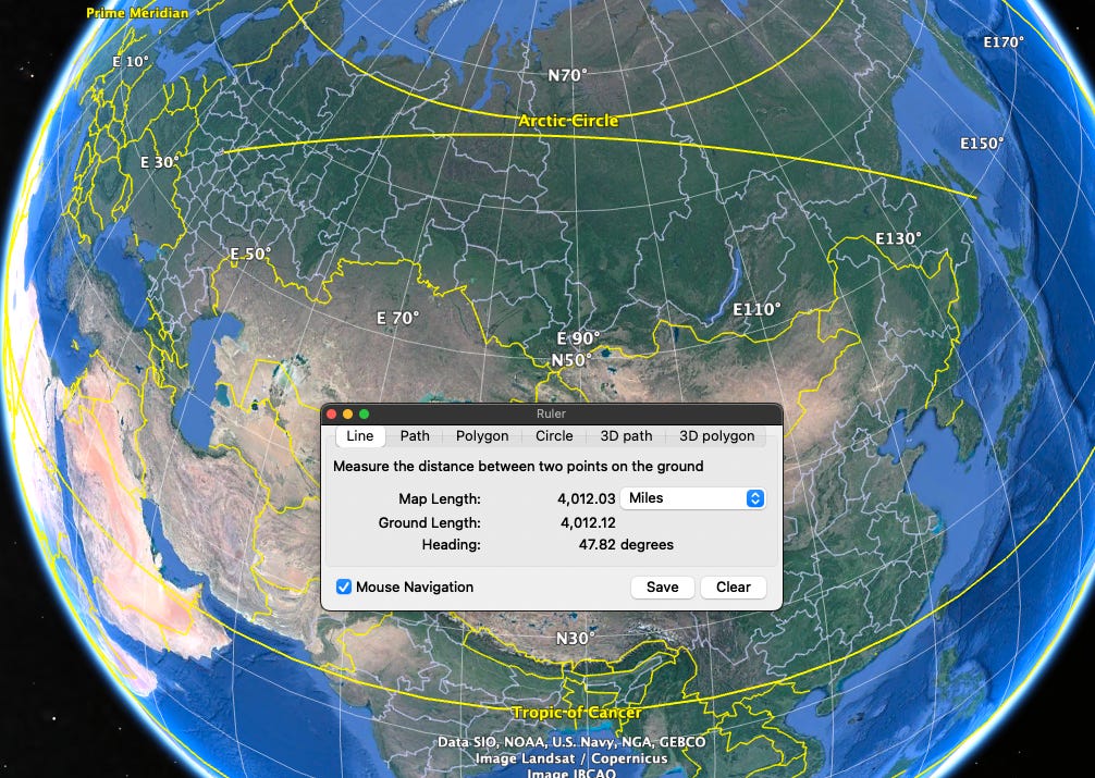
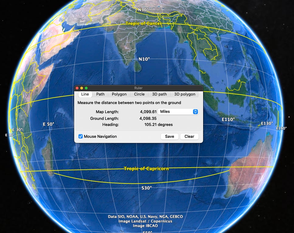
This left me wondering whether to draw the distance from Moscow (A) to: B, C, or D (see image below).
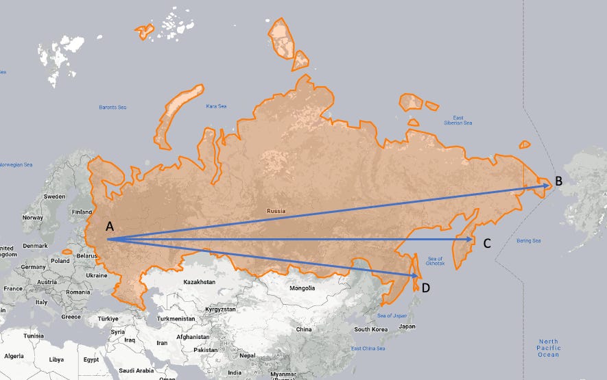
At first, you might think that the obvious and longer distance is from A to B, but, here’s the thing, the actual great circle distance to each of these locations from Moscow is roughly 4,000 miles (give or take about 100 miles). In essence, they’re all about the same distance.
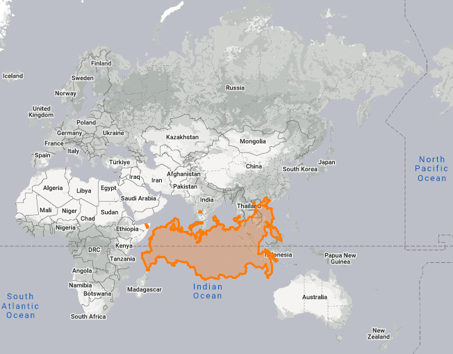
If I drag Russia down to the Equator, you get a better feel for its true overall size and shape, and you can see why these are all equidistant from Moscow.
Here’s how each of these great circle paths measure in distance.
A to B:
A to C:
A to D:
Here’s another interesting thing:
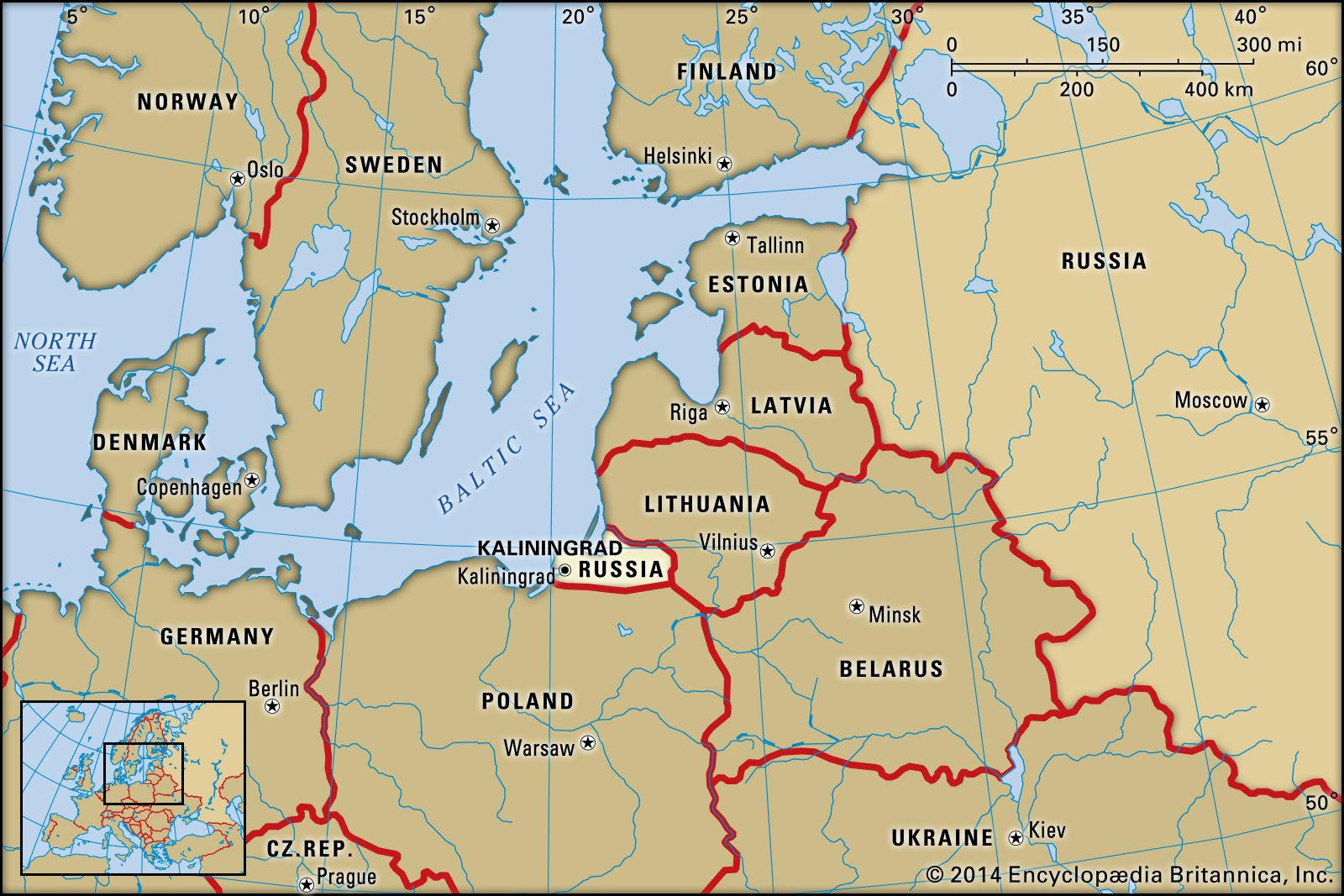
Kaliningrad is an exclave of Russia, which means it is actually part of Russia, but separated from it geographically, just like Alaska is an exclave of the U.S. (read more here). You can see Kaliningrad in the center of the below map.
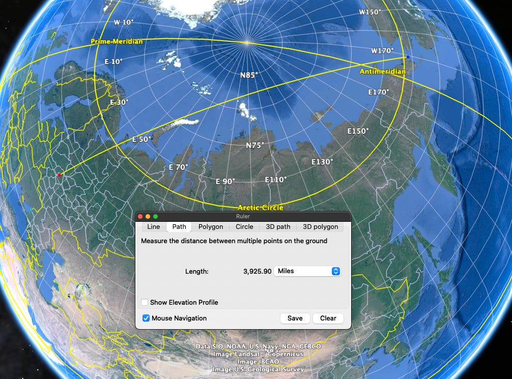
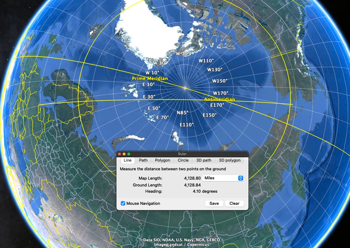
If you go from Kaliningrad (the westernmost part of Russia) to Big Diomede Island (the easternmost part of Russia…which is just a mile from the American Little Diomede Island), the great circle route takes you almost over the North Pole.
Lastly, you may be wondering about the latitudinal length of Russia. Well, that’s little hard to say because the borders are uneven. But, if we take Big Diomede island at a latitude of 65°24’ N and a longitude of 169° W, and then find the longitude of the westernmost part of mainland Russia at that same latitude, which is 29°45’ E, then do the fancy math described in the link way above, it equals about 4,700 miles.
From the west coast of Iran to the east coast of China, we see that it too is about 4,000 miles.
Australia
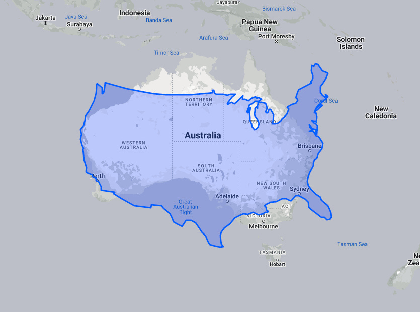
Moving down to Australia, we find that it is roughly 2,500 miles wide—similar to the US.
Wait, really? Yes:
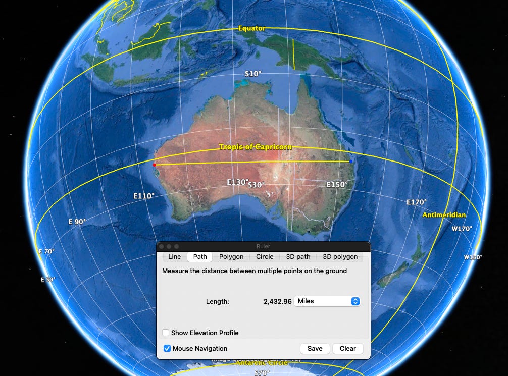
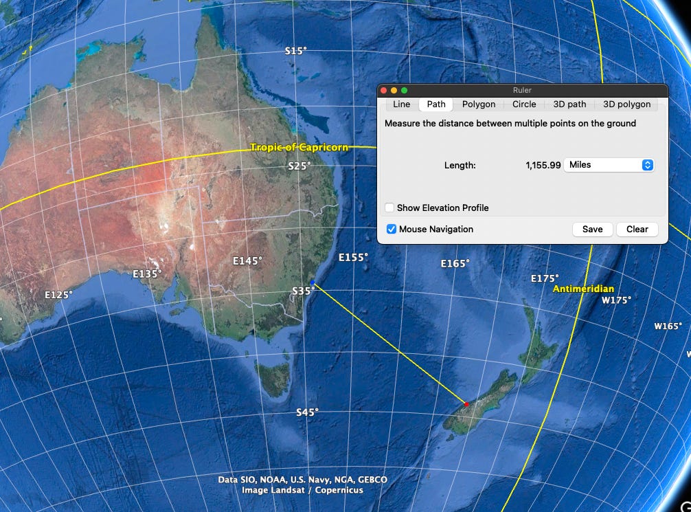
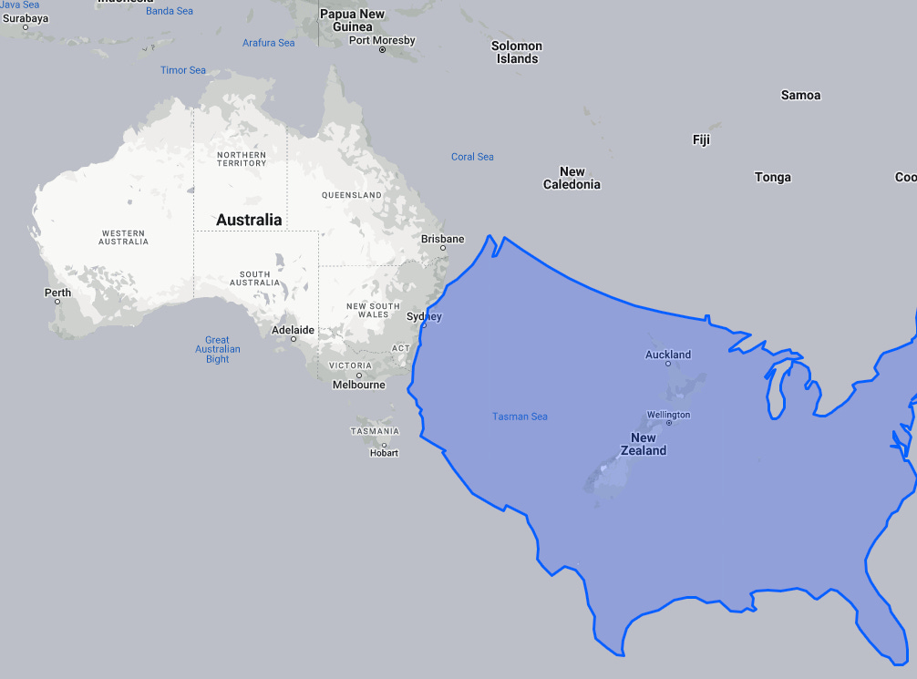
Also note that the distance from Australia to New Zealand is much farther than you probably thought—New Zealand is not sitting “just off” of Australia:
For comparison:
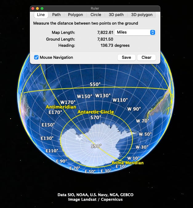
The distance from Australia to Madagascar is roughly 4,000 miles:
As for the distance between Australia and South America, this one isn’t quite as clear. Depending one where you measure to/from, the distances between Australia and South America vary—at their southernmost tips, they are 5,000 miles apart, while near the Tropic of Capricorn, they are nearly 8,000 miles apart. And when I say “nearly,” I actually mean 7,800…but that’s close enough for our bar math.
The distance between Australia and South America is so much greater than that of the distance between the U.S. and Japan due to South America actually sitting southeast of North America, not directly beneath it.
The Pacific
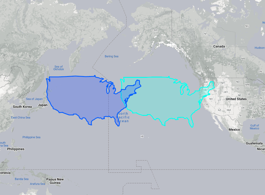
Lastly, let’s jump north—note that the distance between the US and Japan is close to 5,000 miles, or twice the width of the United States.

Yes, that’s the width of the United States two times over:
And, the distance from Hawaii to Japan is nearly 4,000 miles.
Final Thoughts
I’m sure some people will argue that I’ve cherry-picked certain to-from locations in order to get distances that conveniently align with the numbers 2,500, 3,000, and 4,000. And while I did take some liberties on where I picked to-from locations, I would also argue that there are innumerable spots that could’ve been chosen for each country or continent, and I think you’ll find the locations I chose do make sense. Regardless, the idea is to provide you heuristic, and not exact distances.
So, there you go—hopefully this helps you win trivia night at your local bar!
I hope you found this interesting and helpful. If so, hit the heart icon at the top (it makes me feel good), share this with your friends and colleagues, and subscribe (if you don’t already).
In future posts I’m going to provide a method for memorizing names and locations of countries around the world. I’ll make it fun, don’t worry.
